Band combination for Landsat 8 and Sentinel 2 Band combination for Landsat 8 and Sentinel 2
This post is a summery of the original discussion on ESA’s discussion forum, I just place it in one page for easy access.
Landsat 8 band combinations
Natural Color 4 3 2
False Color (urban) 7 6 4
Color Infrared (vegetation) 5 4 3
Agriculture 6 5 2
Atmospheric Penetration 7 6 5
Healthy Vegetation 5 6 2
Land/Water 5 6 4
Natural With Atmospheric Removal 7 5 3
Shortwave Infrared 7 5 4
Vegetation Analysis 6 5 4
The above information is summarized from ESA’s discussion forum
Landsat scenes are categorised into 3 tiers source i.e. raw real time data, tier 1 (where RMSE is less than 12 meters) and tier 2 (where RMSE is more than 2 meters). Also read more here
Sentinel 2
Natural Colors: 4 3 2
False color Infrared: 8 4 3
False color Urban: 12 11 4
Agriculture: 11 8 2
Atmospheric penetration: 12 11 8a
Healthy vegetation: 8 11 2
Land/Water: 8 11 4
Natural Colors with Atmospheric Removal: 12 8 3
Shortwave Infrared: 12 8 4
Vegetation Analysis: 11 8 4
The above information is summarized from ESA’s discussion forum
Following image ESA website also explains the above information in a nice way.
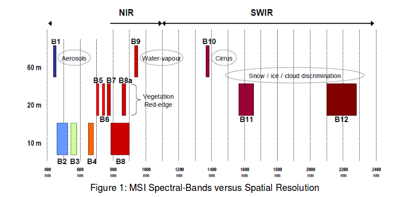
ESA’s Sentinel documentation for Sentinel 2 products